
- 3
Anello Photonics banks on photonics for navigation without GNSS
At Euronaval 2026, the U.S. company Anello Photonics will present Maritime INS, an inertial navigation system (INS) designed for manned and unmanned platforms. Thanks to its SiPhOG optical gyroscopes and a sensor fusion engine, it is designed to maintain precise navigation when GNSS signals are unavailable, jammed or spoofed.
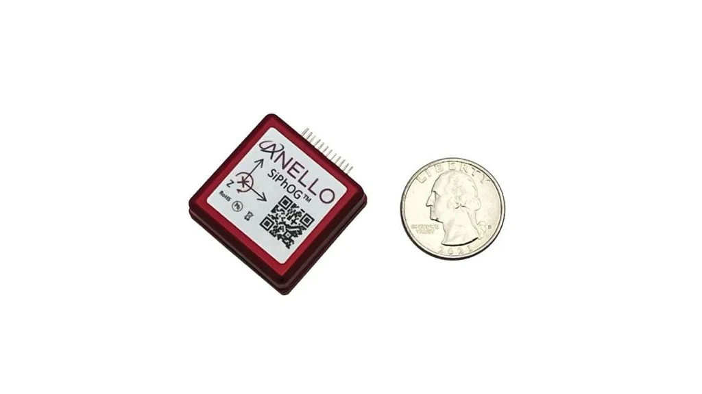
Anello has developed the SiPhOG (Silicon Photonics Optical Gyroscope), an optical gyroscope based on a photonic integrated circuit.
© Anello Photonics
Amidst the continuing proliferation of capabilities to jam and spoof GNSS (Global Navigation Satellite System) signals, autonomous navigation without constant reliance on satellite positioning is becoming an increasingly critical challenge for maritime platforms. It is in this market segment that Anello Photonics intends to establish itself with Maritime INS, which will be presented at Euronaval 2026.
Based in Santa Clara, California, the company specialises in semiconductor-based inertial navigation technologies. In particular, it has developed the SiPhOG (Silicon Photonics Optical Gyroscope), an optical gyroscope based on a photonic integrated circuit.
Silicon-based optical gyroscope
At the heart of Maritime INS are three SiPhOG optical gyroscopes, combined with additional inertial sensors, two GNSS receivers and the sensor fusion engine developed by Anello.
The SiPhOG uses light travelling through a photonic integrated circuit to measure rotational movements. According to Anello, this architecture offers the benefits of an optical gyroscope while maintaining a compact, semiconductor-based design.
The system is designed for uncrewed surface vessels (USVs), autonomous underwater vehicles (AUVs) and remotely operated platforms (ROVs), as well as manned vessels.
The company reports a heading drift of less than 0.5 degrees per hour without external assistance: “This is what enables the system to continue providing navigation information when satellite signals become unavailable.”
Maintaining navigation in GNSS-denied conditions
Anello’s Maritime INS provides position, speed and heading data, and can continue to operate when GNSS signals are denied, degraded, jammed or spoofed.
To limit position drift over time, the system can also utilise various external sources. A new software update presented at Euronaval extends compatibility with external PNT sources, GNSS receivers, water-referenced speed measurement systems and various maritime navigation interfaces.
In particular, the INS can integrate DVL (Doppler Velocity Log) data that complies with industry standards. These sensors measure a vehicle’s speed relative to the seabed, thereby providing an additional reference for the navigation system.
“This is particularly important for AUVs, for which the use of GNSS is inherently limited while they are submerged,” explains Anello.
Up to 0.2% position drift with a DVL
Anello highlights several results obtained during tests carried out without a GPS signal on board a USV.
“With a one-dimensional in-water velocity sensor, such as an impeller or an ultrasonic sensor, we obtained a position drift equivalent to 1–2% of the distance travelled. With a DVL, the reported drift would fall to 0.1–0.2% of the distance travelled,” Anello declares.
These figures represent performance data reported by Anello from the company’s tests. Above all, they illustrate the benefits of combining inertial navigation with various data sources rather than relying on a single sensor for navigation.
The Maritime INS unit is housed in a rugged enclosure reported as IP68-certified. Anello states that it has been designed to withstand the conditions associated with maritime environments: shocks, vibrations, temperature fluctuations, water, dust, salt spray and exposure to certain chemicals.
The new software version presented at Euronaval maintains the advertised navigation performance while expanding integration capabilities. The system can thus utilise a wider range of external sensors and provide on-board systems with information regarding position, speed, trim, heading, synchronisation and system status.
Towards more resilient navigation architectures
For Anello Photonics, the challenge therefore goes beyond simply replacing GNSS. Maritime INS forms part of an architecture in which multiple data sources can be combined to maintain navigation should any one of them become unavailable.
This approach meets the needs not only of autonomous and remotely operated vessels, but also of vessels operating in environments where satellite signals may be disrupted.
With its SiPhOG and sensor fusion engine, Anello is seeking to contribute a new technology building block for maritime navigation architectures, at a time when the ability to continue navigating despite the loss or degradation of GNSS is becoming a major operational challenge.
- Pascal Samama


